Landscape Modeling Tutors & Services: 1-on-1 Online Zoom Training


We are a team of tutors and freelancers that are hireable on an as-needed basis for professional help with your projects.
Enhance your Landscape Modeling skills with 1-on-1 customized online training or get professional services. Get a free 15-minute consultation now!
3 Types of Service
Tutoring
Customized 1-on-1 tutoring sessions. Don't waste time & money in class. Learn only what you need for your specific projects, and nothing more!
Collaborative
Share screens with us to cut costs and learn along the way. More communication increases our understanding of your project.
Contract
Hourly rate or fixed price for agreed upon deliverables and deadlines.
Our 3D Landscape Modeling Tutors & Freelancers
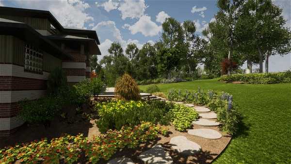
3D Landscape Modeling Gallery
0 Reviews for Tutors & Services
3D Landscape Modeling Services We Provide
Terrain Analysis
Terrain Analysis involves the detailed examination and interpretation of landscape features to determine the physical characteristics of a given area. This sub-service assesses topography, elevation, slopes, and other geographical elements using advanced tools and techniques. The insights gained assist in understanding land usability, planning infrastructure projects, managing natural resources, and mitigating environmental risks.
Vegetation Mapping
Vegetation Mapping provides comprehensive spatial analysis and visualization of plant species distribution and abundance within a landscape. This sub-service utilizes advanced remote sensing techniques, geographic information systems (GIS), and field data to classify vegetation types, monitor ecological changes, and support sustainable land management practices.
Hydrology Simulation
Hydrology Simulation utilizes advanced modeling techniques to accurately represent the movement, distribution, and quality of water within natural and built landscapes. This sub-service provides detailed analysis of watershed dynamics, flood risk assessment, and the impact of land use changes on hydrological processes, enabling more informed decision-making for sustainable water resource management and environmental planning.
Erosion Prediction
Erosion Prediction provides accurate forecasts of soil erosion patterns and rates by leveraging advanced modeling techniques. It aids in identifying vulnerable areas, assessing the impact of land-use changes, and informing sustainable land management practices to mitigate erosion risks.
Land Cover Classification
Land Cover Classification provides comprehensive analysis and categorization of the Earth's surface features using remote sensing technology. This service identifies various land cover types such as forests, urban areas, water bodies, and agricultural lands, facilitating accurate environmental monitoring, resource management, and planning.
Slope Stability Assessment
Slope Stability Assessment involves the evaluation and analysis of slopes to identify potential risks of landslides, soil erosion, and other geotechnical issues. This service employs advanced modeling techniques and geological assessments to determine the stability of natural and engineered slopes, providing critical insights for safe design, construction, and maintenance in landscape projects.
Not sure what you need?
Contact us, and we can point you in the right direction.
About Our Tutors
ON-DEMAND PROFESSIONALS
We are a team of tutors and freelances that are hire-able on an as-needed basis for professional help with your projects. Call us with a quick question, or a big project. Our availability is flexible. We have a variety of skillsets and prices.
SCREEN-SHARE TUTORS AND FREELANCER
We teach remotely, so you can learn from the comfort of your home, from the jobsite, or from the beach! We teach classes via Zoom screen-share, so we can see each others' screens and cursors. It can take hours to search online for 1 simple piece of information, but just minutes to ask your private tutor. Don't struggle alone, get help from a real person online!
Some of our Top Tutors and Freelancers
Remote & On-Demand Help
3D Landscape Modeling Tutors and Services
Get on demand 3D Landscape Modeling classes! We are a team of tutors and freelancers that are hire-able on an as-needed basis for professional help with your projects. Call us with a quick question, or a big project. Our availability is flexible. We teach remotely, so you can learn from the comfort of your home, from the jobsite, or from the beach! We teach classes via Zoom screenshare, so we can see each others' screens and cursors. It can take hours to search online for 1 simple piece of information, but just minutes to ask your private tutor.
Advantages of Online Tutors and Services
Effective
The process of learning 1-on-1 with a live tutor lets you actively participate in the learning. You can immediately repeat a concept in your own words, ask clarifying questions, or demonstrate a concept back to your tutor to ensure understanding.
Efficient
Save time and resources by learning from the comfort of your home. Avoid commuting expenses and focus on learning only the tools you need with personalized lessons tailored to your specific workflow.
Recordable
No need to take notes! We record your lessons so you can replay them at your own pace later. Keep these recordings for future reference and reinforce your learning whenever needed.
Fun
Learning with a dedicated tutor makes the experience enjoyable and interactive. Discuss problems, practice together, and enjoy the human conversational element that brings life to online learning. Reach out anytime you need assistance!
Tutors & Services Philosophy
Don't Learn Alone
Professionals these days are sitting alone and staring at their computers. They spend years searching online for tools that will increase their workplace efficiency. They hunt through forums and watch lengthy videos, trying to find the right pieces of information.
Sometimes they just have one small question that would take a person two minutes to answer, but customer support lines are a thing of the past. Big companies will direct you to an FAQ that will hardly begin to answer your question.
Bring Back the Human Connection
We strive to bring human connection back to the work environment. Our tutors work directly with you to solve your problems, similar to the way an apprentice works hand-in-hand with a skilled professional.
Screen-share technologies like Zoom have allowed us to work together in real time. We can see each others' screens and cursors. We can switch from one screen to another to easily share information. We can even turn on our webcam for a more human interaction.
Tutors, Services, or Both
Sometimes our clients want to learn a program from beginning to end; sometimes they completely hand over the services to us; and other times, they want something in between.
Some clients want to be able to use the program on a basic level and let us do the hard stuff. Others want to co-work with us, supervising our work to ensure their artistic vision is realized. Along the way, they may learn some tools of the trade.
By the end of the process, some clients are able to wean themselves completely off of our services and are empowered to do the work themselves. If they get stuck or behind on a deadline, they use us as a lifeline. They can call anytime—even if it’s just a 10-minute question—we are here to help.
3D Landscape Modeling FAQs
How can I integrate Landscape Modeling with GIS data?
To integrate Landscape Modeling with GIS data, start by importing geospatial data such as elevation, land cover, and hydrology from your GIS software into the landscape modeling tool. Ensure compatibility in coordinate systems and data formats between the GIS and the modeling software. Use GIS layers to define model parameters, such as terrain features and boundary conditions. Then, calibrate the model using these inputs to accurately reflect the real-world landscape. Finally, validate the model using existing GIS data and refine as needed for precision.
What are the main applications of Landscape Modeling in environmental planning?
The main applications of Landscape Modeling in environmental planning include assessing and predicting the impacts of land-use changes, designing sustainable landscapes, managing natural resources, conserving biodiversity, planning urban development, mitigating disaster risks, and supporting climate change adaptation strategies.
What are the hardware requirements for running Landscape Modeling software?
The hardware requirements for running Landscape Modeling software typically include a multi-core processor (Intel i5/i7 or AMD equivalent), at least 16GB of RAM, a dedicated graphics card with at least 4GB of VRAM (NVIDIA GeForce GTX 1060 or AMD equivalent), and a fast SSD with sufficient storage for project files.
What types of data are typically required for Landscape Modeling?
The types of data typically required for Landscape Modeling include topographical data (e.g., digital elevation models), land use/land cover information, soil properties, climate data (e.g., temperature, precipitation), hydrological data (e.g., river flow, catchment boundaries), vegetation types, and human activity patterns (e.g., urban development, agricultural practices).
What training or resources are available to help me understand and use Landscape Modeling software?
To help you understand and use Landscape Modeling software, there are various training and resources available including online tutorials, user manuals, webinars, community forums, and specialized courses offered by software providers or third-party education platforms. Additionally, some software providers offer customer support and consulting services to assist with specific project needs.
How does Landscape Modeling handle changes in land use over time?
Landscape Modeling handles changes in land use over time by incorporating dynamic input data, simulation algorithms, and historical trends to predict future land use scenarios and assess the potential impacts on the environment.
What are the benefits of using Landscape Modeling for urban development planning?
Landscape modeling for urban development planning offers numerous benefits, including: 1. **Enhanced Decision-Making**: Provides a visual representation of potential developments, helping stakeholders to make informed decisions. 2. **Predictive Analysis**: Allows for simulation of various scenarios, forecasting environmental impacts and urban growth patterns. 3. **Sustainable Development**: Assists in identifying the best locations for infrastructure while minimizing ecological disruption. 4. **Resource Management**: Helps in efficient allocation of resources by predicting future needs and potential
How accurate is the Landscape Modeling software in predicting future landscape changes?
The accuracy of Landscape Modeling software in predicting future landscape changes depends on various factors, including the quality of input data, the complexity of the landscape, and the assumptions made in the model. While it can provide useful projections, it is important to consider it as a tool for understanding potential scenarios rather than exact predictions.
What are the common challenges faced when using Landscape Modeling software?
Common challenges faced when using Landscape Modeling software include steep learning curves, high computational resource demands, integration issues with other software, managing large data sets, achieving high levels of detail and realism, limited flexibility or customization options, and dealing with software bugs and updates.
What is the typical workflow for creating a landscape model?
The typical workflow for creating a landscape model involves the following steps: 1. **Conceptualization:** Define the objectives, purpose, and scale of the model. 2. **Data Collection:** Gather relevant data such as topography, soil, vegetation, hydrology, and climate. 3. **Data Processing:** Clean, organize, and preprocess the collected data, often using GIS (Geographic Information Systems) software. 4. **Base Model Creation:** Develop a base model of the landscape using digital elevation
Personalized Landscape Modeling Assistance and Beyond
More Services We Provide
More Software we Teach
Don't Struggle Alone, Get Help From A Real Person
Call or send us a message, and we would be happy to discuss your project.
We offer a free 15 minute consultation!
